
Move in symphony with the nature of our mountains: breathe in the scents of the forest, walk along alpine paths, embrace the snow and let yourself be captivated by a landscape that is renewed every season and invites you to experience new activities.
The call of the mountains
Biodiversity, sport, experiences
-
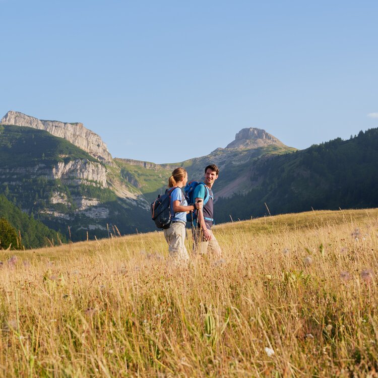
Walking and Trekking
All you need is a rucksack, a pair of boots and plenty of determination to reach your destination.
-
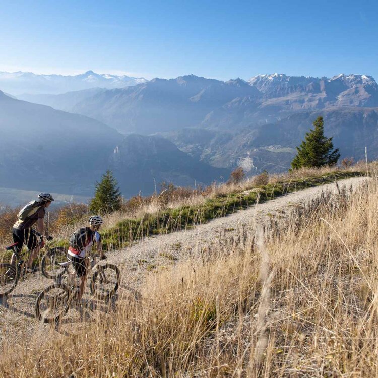
Bike and MTB
Hop on your bike and conquer the mountain: trails, climbs, and descents to enjoy!
-
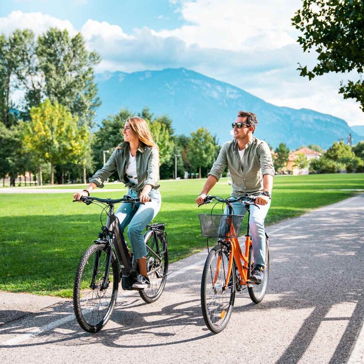
Cycle paths
A network of paths that conveniently connects the historic centre and the main mountain villages.
-
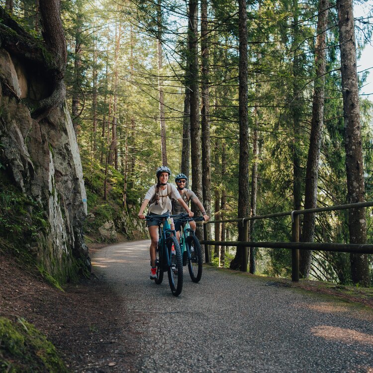
All itineraries
The desire for nature and movement takes shape through the experience of the paths and the routes that cross our region, accompanying and guiding each explorer.
-
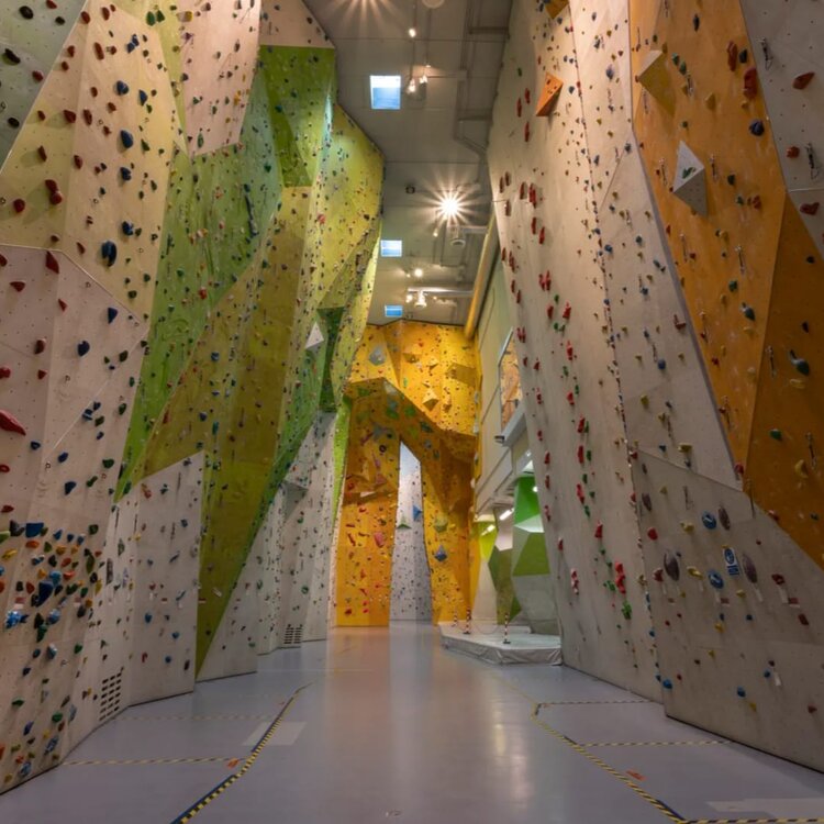
Rock climbing gyms
Our cliffs and bouldering centres await you for a fast-paced, rugged and invigorating climb.
-
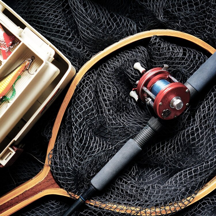
Fishing
With its enormous variety of waters and landscapes, Trentino, in the heart of the Italian Alps, is a perfect spot for fishing.
-
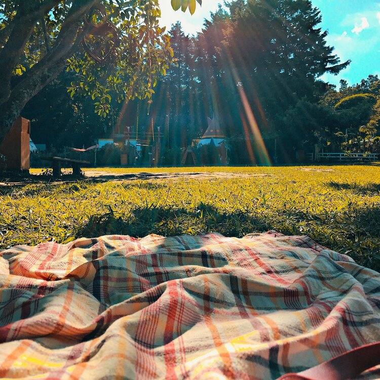
Picnic and BBQ areas
Our region offers the perfect backdrop for a tasty break.
-
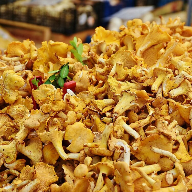
Mushroom picking
All the practical information you need to go mushroom picking responsibly, so as to respect the woods and the local regulations.
-
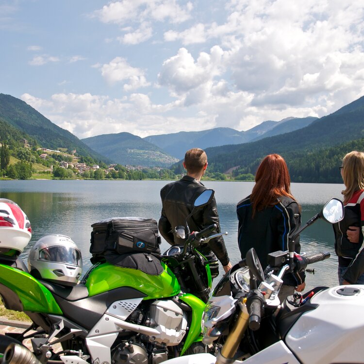
Piné on a motorcycle
Traveling by motorcycle from spring to fall, between the Piné Plateau and the Dolomites.


Our itineraries today
Stay up to date about the conditions of routes and get all the information you need to plan your excursions safely and with peace of mind, choosing the route that best suits your needs.
| Status | Name | Difficulty | Lenght | Height Difference | |
|---|---|---|---|---|---|
|
|
Walk from Baselga to Montagnaga along the cycle path |
|
8.72 km | 71 m | More information |
|
|
The tour of the Maranza fortifications |
|
1.67 km | 90 m | More information |
|
|
From the lake to Ferrari locality - connecting route |
|
3.33 km | 67 m | More information |
|
|
VIOTE - LAGOLO |
|
18.58 km | 868 m | More information |
|
|
Walk on the hills of Baselga |
|
5.75 km | 122 m | More information |
|
|
Malga Stramaiolo - Ex Rifugio Tonini |
|
6.75 km | 229 m | More information |
|
|
From Cimirlo to Chegul |
|
9.99 km | 607 m | More information |
|
|
Viote del Bondone – Bocca dei Vaioni |
|
4.41 km | 148 m | More information |
|
|
EX Malga Albi - Viote |
|
5.95 km | 485 m | More information |
|
|
Visit the MUSE and stop at the Bici Grill! |
|
11.27 km | 12 m | More information |
|
|
Panoramic tour of the Piné Plateau |
|
26.94 km | 537 m | More information |
|
|
Dos de la Mot |
|
3.02 km | 74 m | More information |
|
|
Trekking at Monte Rujoch |
|
10.66 km | 752 m | More information |
|
|
Giro di Bedolpian - the Laghetto delle Rane and the Bellavista |
|
3.35 km | 51 m | More information |
|
|
Monte Calisio trek |
|
8.02 km | 536 m | More information |
|
|
Lakes circuit of the Plateau |
|
9.29 km | 81 m | More information |
|
|
The Marzola tour |
|
10.13 km | 635 m | More information |
|
|
Excursion to the panoramic point Dos del Cuz |
|
5.81 km | 96 m | More information |
|
|
Trekking to Maranza refuge from Bindesi refuge |
|
5.97 km | 463 m | More information |
|
|
Among the woods of Maranza |
|
4.94 km | 175 m | More information |
|
|
Pilgrimage between the Sanctuaries of Montagnaga and Aiuto |
|
50.5 km | 451 m | More information |
|
|
MTB Circuit | Mezavia - Vason |
|
21.21 km | 600 m | More information |
|
|
Giro delle Viote da Vason |
|
20.09 km | 304 m | More information |
|
|
Legendary Charly Gaul climb |
|
36.19 km | 1459 m | More information |
|
|
From Montevaccino to the Calisio Summit |
|
4.94 km | 349 m | More information |
|
|
Walk to the panoramic viewpoint of Dos de La Mot - from loc. Poggio dei Pini |
|
4.12 km | 101 m | More information |
|
|
Between art, sacred and taste in Montagnaga di Piné |
|
8.8 km | 164 m | More information |
|
|
Circuit of the Bedollo mountain passing through Cròs del Cùc and Sas de le Parole |
|
7.42 km | 252 m | More information |
|
|
Refreshing walk in Garniga Terme |
|
7.04 km | 296 m | More information |
|
|
Candriai - Malga Brigolina |
|
3.63 km | 80 m | More information |
|
|
At the city forest |
|
5.51 km | 109 m | More information |
|
|
Walk to the "Val de l’infern" Waterfall |
|
1.13 km | 206 m | More information |
|
|
Multisensory Route from Centrale to Brusago |
|
5.79 km | 54 m | More information |
|
|
From Viote to Lake Lagolo with the E-bike |
|
23.39 km | 737 m | More information |
|
|
Rural walk in Garniga |
|
4.15 km | 122 m | More information |
|
|
Vason - Viote |
|
5.94 km | 95 m | More information |
|
|
Direttissima - From Trento to Vason |
|
18.6 km | 1461 m | More information |
|
|
Marzola loop by MTB |
|
24.87 km | 742 m | More information |
|
|
Cycle path from Baselga to Montagnaga |
|
18.58 km | 234 m | More information |
|
|
Snowshoeing to the panoramic point of Cròs del Cùc |
|
4.39 km | 186 m | More information |
|
|
Winter trekking to Monte Cogne |
|
8.36 km | 469 m | More information |
|
|
From Segonzano to Palù del Fersina along the E5 |
|
13.75 km | 852 m | More information |
|
|
Trekking from Sopramonte to Capanna Viote |
|
14.72 km | 902 m | More information |
|
|
A short walk around Ceramont |
|
7.92 km | 211 m | More information |
|
|
Dosso di Costalta from Passo del Redebus (404) and return via "Senter dei Russi" (E457) |
|
9.96 km | 504 m | More information |
|
|
Snowshoeing around Ceramont |
|
7.92 km | 200 m | More information |
|
|
Cimone - Doss D'Abramo Trekking (SAT route 638) |
|
12.38 km | 1438 m | More information |
|
|
Cascata del Lupo for children |
|
0.87 km | 90 m | More information |
|
|
Inside the Celva fortifications |
|
3.86 km | 267 m | More information |
|
|
Laghestel Nature Reserve Itinerary |
|
6.44 km | 66 m | More information |
|
|
From Campel to the Calisio Summit |
|
6.38 km | 362 m | More information |
|
|
Trekking Ravina - Parolet |
|
10.67 km | 1347 m | More information |
|
|
Walk to the Le Grave Biotope |
|
3.22 km | 99 m | More information |
|
|
At the Viote of Bondone with snowshoes |
|
5.21 km | 261 m | More information |
|
|
Giro degli Gnomi |
|
5.17 km | 110 m | More information |
|
|
Between meadows and lakes in the Municipality of Bedollo |
|
11.64 km | 206 m | More information |
|
|
Kite Path |
|
4.91 km | 273 m | More information |
|
|
Cascata del Lupo from Piazze di Bedollo |
|
1.76 km | 178 m | More information |
|
|
Tre Cime del Bondone Circuit - from Cornetto to Cima Verde |
|
10.43 km | 584 m | More information |
|
|
Route 866 - Malga Vernera |
|
13.52 km | 633 m | More information |
|
|
From Bindesi to Forte Brusaferro |
|
7.76 km | 356 m | More information |
|
|
Cyclotourism along the Adige plain |
|
64.02 km | 283 m | More information |
|
|
Wolf Waterfall from loc. Varda |
|
2.36 km | 103 m | More information |
|
|
Monte Calvo |
|
16.03 km | 538 m | More information |
|
|
Malga Cambroncoi from the “Russian Path” |
|
6.59 km | 267 m | More information |
|
|
Landscapes and enogastronomic specialities of the Piné Plateau |
|
16.31 km | 262 m | More information |
|
|
Cycle path of the lakes: Lake Serraia, Lake delle Piazze and Lake delle Buse |
|
18.02 km | 141 m | More information |
|
|
With stroller or on foot from Loc. Ferrari to Montagnaga |
|
10.45 km | 71 m | More information |
|
|
Trekking to Monte Cogne |
|
8.36 km | 469 m | More information |
|
|
From the former Barracks to Parolet along the military road (round trip same route) |
|
7.9 km | 174 m | More information |
|
|
At Cròs del Cuc |
|
4.39 km | 186 m | More information |
|
|
Dosso di Costalta from Miola di Piné |
|
14.02 km | 961 m | More information |
|
|
Wolf Waterfall and Segonzano Pyramids along the Val Regnana |
|
10.52 km | 496 m | More information |
|
|
Walk to Bindesi Refuge |
|
2.34 km | 147 m | More information |
|
|
Maranza Refuge - La Marzola Peak |
|
8.19 km | 635 m | More information |
|
|
From Passo del Redebus to Malga Stramaiolo |
|
7.77 km | 220 m | More information |
|
|
Sentiero delle Canope |
|
3.27 km | 102 m | More information |
|
|
Flavors and relaxation along the lakes of Piné |
|
9.43 km | 85 m | More information |
|
|
Dosso di Costalta from Miola di Piné in winter |
|
13.89 km | 961 m | More information |
|
|
From Buonconsiglio to Doss Trento |
|
5.94 km | 117 m | More information |
|
|
Wolf Waterfall from loc. Marteri |
|
1.87 km | 144 m | More information |
|
|
9 lakes route |
|
116.03 km | 707 m | More information |
|
|
Alternative E5 route for Brusago - Malga Stramaiolo (high route) |
|
14.7 km | 803 m | More information |
|
|
Bedollo - Brusago Path |
|
5.63 km | 106 m | More information |
|
|
Trekking to the Pontara - Lemperperg Summit: watershed mountain between the Altopiano di Pinè and the val dei Mocheni |
|
10.87 km | 535 m | More information |
|
|
Former Malga Albi - Cima Verde (upper part of the SAT 630 route) |
|
7.59 km | 834 m | More information |
|
|
The Laghestel biotope from Loc. Ferrari |
|
4.29 km | 31 m | More information |
|
|
Snowshoe hike to Malga Stramaiolo |
|
9.4 km | 288 m | More information |
|
|
Trekking Baitol - Monte Croce |
|
18.24 km | 1330 m | More information |
|
|
Walk to the Laghestel Biotope in winter |
|
5.64 km | 65 m | More information |
|
|
Giro del Manghen |
|
106.58 km | 1627 m | More information |
|
|
From Aldeno to S. Osvaldo of Garniga Nuova |
|
10.86 km | 605 m | More information |
|
|
Short chestnut grove walk of Sardagna |
|
5.75 km | 209 m | More information |
|
|
Tour of the the Piné Plateau lakes in winter |
|
9.26 km | 81 m | More information |
|
|
From S. Anna to the Redeemer |
|
2.01 km | 49 m | More information |
|
|
Lake Serraia - Lago delle Piazze itinerary |
|
9.24 km | 75 m | More information |
|
|
High altitude route of the Valle dei Mocheni starting from Piné |
|
61.37 km | 1504 m | More information |
|
|
Tour 858 - Costalta |
|
22.58 km | 970 m | More information |
|
|
Route 869 - Croce del Cùc |
|
13.26 km | 519 m | More information |
|
|
Tour 856 - Villages of Baselga di Piné |
|
28.97 km | 347 m | More information |
|
|
Tour 868 - Heart of the Lagorai |
|
39.16 km | 777 m | More information |
|
|
Route 857 - Bellavista Ceramont |
|
21.95 km | 329 m | More information |
|
|
Route 865 - Pyramids |
|
17.98 km | 633 m | More information |
|
|
Route 864 - Malga dal Sas |
|
23.59 km | 879 m | More information |
|
|
Route 859 - Brada |
|
17.49 km | 677 m | More information |
|
|
Tour 867 - Villages of Bedollo |
|
18.76 km | 310 m | More information |
| Status | Name | Difficulty | Lenght | Height Difference | |
|---|---|---|---|---|---|
|
|
Walk from Baselga to Montagnaga along the cycle path |
|
8.72 km | 71 m | More information |
|
|
The tour of the Maranza fortifications |
|
1.67 km | 90 m | More information |
|
|
From the lake to Ferrari locality - connecting route |
|
3.33 km | 67 m | More information |
|
|
Viote del Bondone – Bocca dei Vaioni |
|
4.41 km | 148 m | More information |
|
|
EX Malga Albi - Viote |
|
5.95 km | 485 m | More information |
|
|
Dos de la Mot |
|
3.02 km | 74 m | More information |
|
|
Giro di Bedolpian - the Laghetto delle Rane and the Bellavista |
|
3.35 km | 51 m | More information |
|
|
Among the woods of Maranza |
|
4.94 km | 175 m | More information |
|
|
From Montevaccino to the Calisio Summit |
|
4.94 km | 349 m | More information |
|
|
Circuit of the Bedollo mountain passing through Cròs del Cùc and Sas de le Parole |
|
7.42 km | 252 m | More information |
|
|
Refreshing walk in Garniga Terme |
|
7.04 km | 296 m | More information |
|
|
Candriai - Malga Brigolina |
|
3.63 km | 80 m | More information |
|
|
At the city forest |
|
5.51 km | 109 m | More information |
|
|
Walk to the "Val de l’infern" Waterfall |
|
1.13 km | 206 m | More information |
|
|
Multisensory Route from Centrale to Brusago |
|
5.79 km | 54 m | More information |
|
|
Rural walk in Garniga |
|
4.15 km | 122 m | More information |
|
|
Vason - Viote |
|
5.94 km | 95 m | More information |
|
|
Inside the Celva fortifications |
|
3.86 km | 267 m | More information |
|
|
Laghestel Nature Reserve Itinerary |
|
6.44 km | 66 m | More information |
|
|
Walk to the Le Grave Biotope |
|
3.22 km | 99 m | More information |
|
|
Between meadows and lakes in the Municipality of Bedollo |
|
11.64 km | 206 m | More information |
|
|
Kite Path |
|
4.91 km | 273 m | More information |
|
|
From Bindesi to Forte Brusaferro |
|
7.76 km | 356 m | More information |
|
|
Wolf Waterfall from loc. Varda |
|
2.36 km | 103 m | More information |
|
|
Walk to Bindesi Refuge |
|
2.34 km | 147 m | More information |
|
|
Sentiero delle Canope |
|
3.27 km | 102 m | More information |
|
|
Flavors and relaxation along the lakes of Piné |
|
9.43 km | 85 m | More information |
|
|
From Buonconsiglio to Doss Trento |
|
5.94 km | 117 m | More information |
|
|
Wolf Waterfall from loc. Marteri |
|
1.87 km | 144 m | More information |
|
|
Short chestnut grove walk of Sardagna |
|
5.75 km | 209 m | More information |
|
|
Lake Serraia - Lago delle Piazze itinerary |
|
9.24 km | 75 m | More information |
| Status | Name | Difficulty | Lenght | Height Difference | |
|---|---|---|---|---|---|
|
|
VIOTE - LAGOLO |
|
18.58 km | 868 m | More information |
|
|
Malga Stramaiolo - Ex Rifugio Tonini |
|
6.75 km | 229 m | More information |
|
|
From Cimirlo to Chegul |
|
9.99 km | 607 m | More information |
|
|
Trekking at Monte Rujoch |
|
10.66 km | 752 m | More information |
|
|
Monte Calisio trek |
|
8.02 km | 536 m | More information |
|
|
The Marzola tour |
|
10.13 km | 635 m | More information |
|
|
Trekking to Maranza refuge from Bindesi refuge |
|
5.97 km | 463 m | More information |
|
|
Direttissima - From Trento to Vason |
|
18.6 km | 1461 m | More information |
|
|
Trekking from Sopramonte to Capanna Viote |
|
14.72 km | 902 m | More information |
|
|
A short walk around Ceramont |
|
7.92 km | 211 m | More information |
|
|
Dosso di Costalta from Passo del Redebus (404) and return via "Senter dei Russi" (E457) |
|
9.96 km | 504 m | More information |
|
|
Cimone - Doss D'Abramo Trekking (SAT route 638) |
|
12.38 km | 1438 m | More information |
|
|
From Campel to the Calisio Summit |
|
6.38 km | 362 m | More information |
|
|
Trekking Ravina - Parolet |
|
10.67 km | 1347 m | More information |
|
|
Cascata del Lupo from Piazze di Bedollo |
|
1.76 km | 178 m | More information |
|
|
Tre Cime del Bondone Circuit - from Cornetto to Cima Verde |
|
10.43 km | 584 m | More information |
|
|
Trekking to Monte Cogne |
|
8.36 km | 469 m | More information |
|
|
From the former Barracks to Parolet along the military road (round trip same route) |
|
7.9 km | 174 m | More information |
|
|
Dosso di Costalta from Miola di Piné |
|
14.02 km | 961 m | More information |
|
|
Wolf Waterfall and Segonzano Pyramids along the Val Regnana |
|
10.52 km | 496 m | More information |
|
|
Maranza Refuge - La Marzola Peak |
|
8.19 km | 635 m | More information |
|
|
Trekking to the Pontara - Lemperperg Summit: watershed mountain between the Altopiano di Pinè and the val dei Mocheni |
|
10.87 km | 535 m | More information |
|
|
Former Malga Albi - Cima Verde (upper part of the SAT 630 route) |
|
7.59 km | 834 m | More information |
|
|
Trekking Baitol - Monte Croce |
|
18.24 km | 1330 m | More information |
|
|
From Aldeno to S. Osvaldo of Garniga Nuova |
|
10.86 km | 605 m | More information |
| Status | Name | Difficulty | Lenght | Height Difference | |
|---|---|---|---|---|---|
|
|
Visit the MUSE and stop at the Bici Grill! |
|
11.27 km | 12 m | More information |
|
|
Cyclotourism along the Adige plain |
|
64.02 km | 283 m | More information |
| Status | Name | Difficulty | Lenght | Height Difference | |
|---|---|---|---|---|---|
|
|
Excursion to the panoramic point Dos del Cuz |
|
5.81 km | 96 m | More information |
|
|
Snowshoeing to the panoramic point of Cròs del Cùc |
|
4.39 km | 186 m | More information |
|
|
Snowshoeing around Ceramont |
|
7.92 km | 200 m | More information |
|
|
At the Viote of Bondone with snowshoes |
|
5.21 km | 261 m | More information |
|
|
Malga Cambroncoi from the “Russian Path” |
|
6.59 km | 267 m | More information |
|
|
Snowshoe hike to Malga Stramaiolo |
|
9.4 km | 288 m | More information |
| Status | Name | Difficulty | Lenght | Height Difference | |
|---|---|---|---|---|---|
|
|
MTB Circuit | Mezavia - Vason |
|
21.21 km | 600 m | More information |
|
|
Giro delle Viote da Vason |
|
20.09 km | 304 m | More information |
|
|
Marzola loop by MTB |
|
24.87 km | 742 m | More information |
|
|
Route 866 - Malga Vernera |
|
13.52 km | 633 m | More information |
|
|
Monte Calvo |
|
16.03 km | 538 m | More information |
|
|
Tour 858 - Costalta |
|
22.58 km | 970 m | More information |
|
|
Route 869 - Croce del Cùc |
|
13.26 km | 519 m | More information |
|
|
Tour 856 - Villages of Baselga di Piné |
|
28.97 km | 347 m | More information |
|
|
Tour 868 - Heart of the Lagorai |
|
39.16 km | 777 m | More information |
|
|
Route 857 - Bellavista Ceramont |
|
21.95 km | 329 m | More information |
|
|
Route 865 - Pyramids |
|
17.98 km | 633 m | More information |
|
|
Route 864 - Malga dal Sas |
|
23.59 km | 879 m | More information |
|
|
Route 859 - Brada |
|
17.49 km | 677 m | More information |
|
|
Tour 867 - Villages of Bedollo |
|
18.76 km | 310 m | More information |
| Status | Name | Difficulty | Lenght | Height Difference | |
|---|---|---|---|---|---|
|
|
Legendary Charly Gaul climb |
|
36.19 km | 1459 m | More information |
|
|
9 lakes route |
|
116.03 km | 707 m | More information |
|
|
Giro del Manghen |
|
106.58 km | 1627 m | More information |
| Status | Name | Difficulty | Lenght | Height Difference | |
|---|---|---|---|---|---|
|
|
Winter trekking to Monte Cogne |
|
8.36 km | 469 m | More information |
|
|
Dosso di Costalta from Miola di Piné in winter |
|
13.89 km | 961 m | More information |
|
|
Walk to the Laghestel Biotope in winter |
|
5.64 km | 65 m | More information |
|
|
Tour of the the Piné Plateau lakes in winter |
|
9.26 km | 81 m | More information |
Suggestions to share
Here you will find a collection of the most popular experiences and most loved content that captures the stories of both visitors and residents. True beauty comes from sharing and transforming every occasion into a treasured memory.
Prepare for your visit
Everything you need to plan your trip and your stay in the area: advice, itineraries, practical information and accurate, up-to-date tips.